Transport geography and the Georgian-Abkhaz conflict
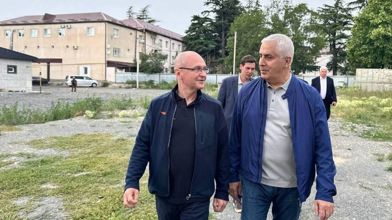
Transport geography occupies a special place in conflicts, yet in the post-Soviet space, this topic is among the least studied. We interviewed Eleonora Tchania, a researcher of human geography and conflicts, who tells us about the role of geography in peacebuilding, the development of transport infrastructure to facilitate conflict transformation, Abkhazia’s main transport hubs, the Enguri bridge, maritime ports, and other important issues that define the everyday life of the population living under the conditions of an unresolved conflict.
Transport geography is particularly important in peace and conflict research because it shows how space, movement, and social relations are connected to each other. According to one of the fundamental principles of geography, interaction between closely located spaces is more intensive.
This means that proximity can simultaneously become a source of both cooperation and tension. Transport geography plays an important role both in making sense of conflicts and in building peace, as it shows us how space is organized and who has access to movement.
A conflict environment rarely exists abstractly; it is always connected to specific territories, roads, boundaries, and the logic of movement. Under conflict conditions, transport often becomes an instrument of control and power: closing roads, restricting movement, or the militarization of infrastructure strengthens isolation and social division. In such cases, transport geography helps us see how space is transformed into a fragmented and unequal environment.
From a peacebuilding perspective, transport represents the basis for connection and interdependence. Roads, transport hubs, and everyday mobility create spaces where people interact, trade, and restore trust with one another. It is precisely these daily movements that form peace as a process and not just as a political agreement.
Along with this, in post-conflict recovery, the rehabilitation of transport infrastructure is one of the first and most important steps. It facilitates the return of displaced persons, the revival of the local economy, and the reconnection of society.
It is important that the development of infrastructure be conflict-sensitive (fair, inclusive, and taking local needs into account). Otherwise, it may turn into a source of inequality and new tension. Transport infrastructure is not limited only to a technical function.
It represents a spatial-social structure where knowledge, power, and the rules of coexistence intersect, and which determines the forms of human interaction, access to resources, and the configuration of the political order.
From this point of view, transport can simultaneously become both a mechanism of connection and integration, and an instrument of demarcation and fragmentation.
In this context, transport geography unites space, politics, and everyday life and offers an analytical tool for understanding how movement can become either an enhancer of conflict or the basis for sustainable peace.
The logic of Abkhazia’s transport network is formed under the influence of two main geographical factors: the Black Sea coastal location and the presence of a powerful natural barrier from the north – the Caucasus Mountain system. These circumstances determine the spatial direction of transport lines, their concentration, and their functional load.
To make sense of the existing reality, it is advisable to view the transport-geographic position of Abkhazia from the perspective of three periods/epochs: before the Soviet occupation, within the framework of the Soviet Union, and after the Georgian-Abkhaz conflict.
Before the formation of land transport infrastructure, i.e., before the Soviet occupation, Abkhazia effectively represented a transport dead-end located in the extreme northwestern part of Georgia, which was significantly cut off from the country’s main economic centers.
Until the construction of the Black Sea coastal highway and the railway line, the potential of this geographical location could not be fully realized. In the Soviet period, the main backbone of developed land roads and the railway main line was located in the coastal strip and followed the sea shore almost along its entire length.
This arrangement was conditioned by relief features: the coastal lowland represented the most accessible space for transport infrastructure, while the mountainous zone, especially the Gagra Range and other branches of the Caucasus, created a powerful natural barrier. As a result of this, both the railway and the Black Sea Highway were formed as the main supporting arteries of Abkhazia’s transport system, around which economic and communicative activity concentrated.
Important land transit communications passed through the territory of Abkhazia, through which Georgia, Armenia, and partially Azerbaijan were connected to the European part of the RSFSR and Ukraine. The mentioned infrastructure played a vital role in the transport service of the economic-geographic district: it connected the subtropical zones of Georgia, a significant part of the population, resorts, and industrial centers.
Roads coming from the mountainous districts joined these two main communication lines, and through the ports of Abkhazia, sea routes joined them as well. The railway and the highway developed almost parallelly and at a close distance from each other along the entire coastal strip. The network of automobile roads mostly followed river valleys and pass directions, which made the movement of resources and the displacement of the population from mountain zones possible.
The “Black Sea Highway” represented an artery of not only local but also transit significance, which united coastal cities and resorts and provided intensive flows of cargo and passengers. In intra-district shipments and passenger movement, automobile transport was particularly important.
Under the conditions of Abkhazia’s mountainous relief, auto-transport represented an economically more favorable means of transport, as it was characterized by high passage capability and maneuverability. In the Soviet period, the process of bringing timber down from the mountain districts caused the expansion of the road network, and the rapid growth of the economy and resorts further accelerated the development of auto-transport.
At the same time, the road network was distributed unevenly: its main part concentrated in the lowland zone, while the roads connecting the coastal districts with mountainous Abkhazia passed almost entirely through river valleys (Enguri, Ghalidzga, Kodori, Kelasuri, Bzipi, Psou, etc.).
At the current stage, it can be said that Abkhazia is a space concentrated on auto-transport. In conditions where the territory is isolated from international transport networks, auto-transport remains the most flexible and practically accessible means of mobility. The coastal highway from north to south unites the main settlements and creates a continuous line from the Psou border point through Sukhumi in the direction of Ochamchire and Gali.
This road, both historically and today, reflects that part of the space where population, tourist activity, and economic resources are concentrated. Most internal movement is carried out by small-sized buses, minibuses, and taxis. The roads connecting villages and cities are often the only channel through which the population connects with administrative centers, markets, and services.
The role of auto-transport particularly increases in mountainous and semi-mountainous zones, where alternative transport means practically do not exist. Auto-transport has a special load in connection with Russia as well: the roads going out in the direction of Psou connect Abkhazia to the Russian economic space and provide for the movement of people and the shipment of goods and fuel.
At the same time, movement in the direction of the Enguri line is strictly limited, which turns the road network into an asymmetrical and politically charged space.
What was and remains the importance of railway transport for Abkhazia?
The construction of the Black Sea coastal electrified railway connected Abkhazia with the other regions of Georgia, the North Caucasus, and the European part of the Soviet Union. Railway transport represented the leading type of land shipments for Abkhazia and accounted for the main part of the cargo turnover.
The Black Sea railway main line (Samtredia–Tuapse) and its branch (Ochamchire–Akarmara) served both transit flows and the needs of the local economy. Stations located in coastal cities became communication hubs where land and sea transport merged with each other. In the railway system of Abkhazia, transport hubs located on the Black Sea main line occupy/occupied an important place: Sukhumi, Ochamchire, Gudauta, Gagra, New Athos, and other points.
These stations provided for the intersection of both sea and land communications and the connection between districts. A special role was held by those stations that were located at the intersection of roads coming from mountain zones and served the shipment of timber, construction materials, agricultural, and industrial cargo (Gali, Tamishi, Bzipi, Gantiadi, Kelasuri). Coal was transported via the railway line between Ochamchire and Tkvarcheli.
Both cargo and passenger infrastructure functioned in Sukhumi – the city passenger station and the platform named after Baratashvili. Despite the fact that tunnels and overpasses were built during the construction of the railway, the main line still complicated the internal connection of the city and was negatively reflected on the urban environment, especially due to noise.
Until the 1990s, the Abkhazian railway was part of the Transcaucasian railway system. After the collapse of the Soviet Union and the armed phase of the Georgian-Abkhaz conflict, the so-called Abkhazian Railway was created. At the current stage, the railway here represents more a symbol of structural memory and politico-geographic reality; its physical existence is obvious, though its functional load is sharply reduced.
The absence of movement in the direction of Enguri turns the railway into a broken line that has lost the function of regional and international transit. Today, the railway in Abkhazia functions partially and is mainly oriented toward the north, in the direction of Russia.
It serves both the transport of passengers and limited cargo flows. In Sukhumi and other coastal cities, the stations are still operational, though their role in local mobility is secondary compared to auto-transport. It is noteworthy that one version of the start of the Georgian-Abkhaz conflict is linked precisely to the pretext of protecting the railway.
On August 14, 1992, the explosion of the railway bridge located on the Enguri river stopped railway movement in Abkhazia. In May 2008, a few months before the intervention in Georgia, the Russian Federation illegally began the restoration of the railway section on the territory of Abkhazia, which was used for military purposes during the August 2008 war.
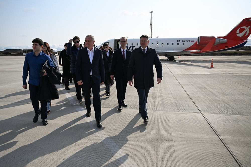
On the basis of the agreement of December 24, 2010, the rehabilitation of the railway was carried out and the functioning of the electrified section from the Psou platform to the Sukhumi station was restored. Cargo and passenger movement is carried out on this line, while the sole passenger carrier is “Russian Railways.” From May 1, 2025, movement was started by the tourist electric train “Dioscuria.”
Generally, the sea did not represent only a transport space for Abkhazia. It was the main channel for economic openness, cultural interaction, and social mobility. The socio-economic and cultural formation of Abkhazia as a maritime region was significantly connected to maritime transport and ports.
By the end of the 19th century, in terms of commodity exchange, Abkhazia was more closely integrated with the countries of the Black and Mediterranean sea basins than with the internal districts of Russia. This was conditioned by the relative cheapness of sea travel, technical simplicity, and the weak development of land infrastructure, which had a peculiar influence on the socio-cultural flavor of cities and settlements.
In those conditions where until 1931 electrified railway lines did not exist in the region and land roads were insufficiently developed, maritime transport effectively performed the function of the main communication system. It was precisely through the ports that the movement of cargo, migration of the population, trade relations, and connection with the outside world were carried out.
Ports turned into spaces where economic activity concentrated and social dynamics were formed. Service spheres, trade infrastructure, labor force, and professional groups developed around them, which was directly reflected on the internal structure of the local society. Coastal settlements were involved in regional and international processes earlier and more intensively than internal territories.
The role of maritime transport became particularly obvious even when at the end of the 19th century a road was built between Sukhumi and Zugdidi: despite this, the main part of the movement of cargo and passengers was again carried out by sea. Ports represented spatial and social centers that determined the rhythm of economic life. The Sukhumi harbor, as the main maritime hub, had a special influence on the urban development of the city.
After the reconstruction of the harbor, its throughput capacity and economic significance grew, which facilitated population growth, the expansion of jobs, and the functional differentiation of the city. Sukhumi was formed not only as an administrative but also as a socio-cultural center, where new practices, connections, and ideas entered via the sea.
Other coastal ports and piers – Ochamchire, Gagra, Gudauta, New Athos, Pitsunda – played an important role in ensuring local mobility and everyday social relations. They connected coastal settlements with each other and created a kind of “maritime social network” through which the population participated in economic and cultural exchange.
Maritime transport had special importance in the process of the development of resorts and tourism. The growth of passenger turnover turned ports into centers of social contact, seasonal employment, and the formation of a service culture. Ports influenced social behaviors, the use of space, and local identity.
At the current stage, Abkhazia’s maritime transport has functioned and functions in a limited, fragmented, and structurally fragile regime. The ports located on the coastal strip, primarily the ports of Sukhumi and Ochamchire, maintain physical existence and a partially operational function, though their role significantly differs from historical periods. Cargo turnover of a small volume is carried out in the mentioned ports, which is mainly oriented toward the shipment of construction materials, fuel, and raw materials.
At the same time, their operational scale does not reach the functional load of a classic commercial port and full inclusion in international logistical systems. Maritime transport of passengers in modern Abkhazia practically does not represent a systemic transport direction. Ports are not integrated into international passenger routes, while tourist navigation bears an episodic and sharply seasonal character.
As a result, maritime transport can no longer perform that social and spatially integrated function which it historically had in the formation of the local society. In this situation, ports maintain symbolic and local significance more than they are transformed into active centers of social mobility and cultural interaction.
Their modern functioning reflects not only economic limitations but also the politico-geographic isolation existing in the region, which is directly reflected on the social role of the maritime space. Accordingly, ports today no longer represent dynamic centers of social life, but function as infrastructure elements with limited access, whose influence on the formation of the local society is significantly reduced.
In the pre-war period, Abkhazia’s main communications – the Black Sea coastal automobile road, the railway main line, and sea lines – performed a connecting and integration function more than the role of sharp spatial division of local groups. Their logic was directed not toward the strengthening of ethnic or social boundaries, but toward the formation of the coastal space as a unified economic and communicative system.
Main communications in Abkhazia were spatially organized so that they connected territories inhabited by various ethnic, social, and professional groups with each other. The railway and the Black Sea Highway followed the coastal strip almost continuously and connected multi-ethnic cities and resorts – Sukhumi, Gagra, Gudauta, Ochamchire, and Gali – with each other. Everyday movement on these roads facilitated regular contact of the population, labor mobility, and economic interdependence.
Particularly important was the role of the railway as a mechanism of spatial integration. Railway stations functioned not only as transport points but also as spaces of social meeting where everyday routes of the population coming from different regions and social layers intersected.
Markets, resorts, workplaces, and administrative centers concentrated precisely around the accessibility of main communications, which increased the intensity of relations between groups. At the same time, automobile and maritime transport supplemented the network of main communications and created multi-level mobility: the interconnection of coastal and mountainous districts, cities and villages, work and residential spaces.
This system facilitated social mixing not through forced assimilation, but on the basis of everyday coexistence and practical interdependence. However, it must be noted that despite this integration effect, main communications could not fully erase existing social differences.
Mountainous districts and internal territories still remained in a relatively peripheral position, which created spatial asymmetries. But this asymmetry bore more of an economic-geographic character and not a clear ethno-spatial segregation.
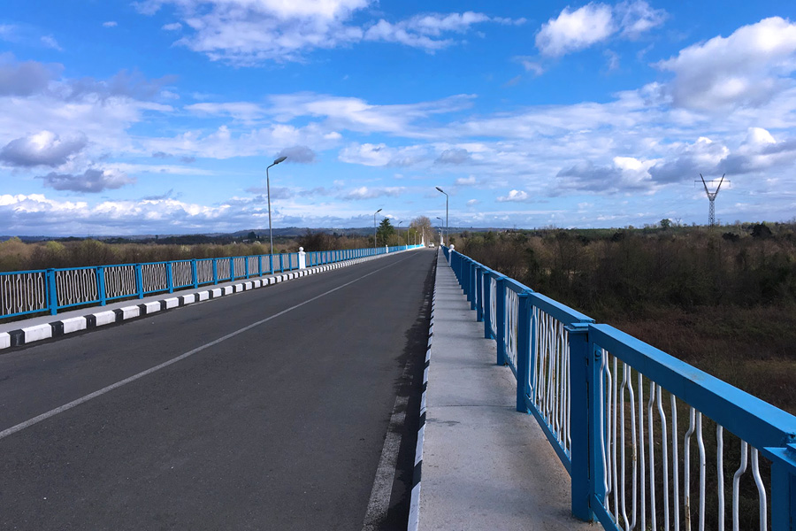
The Enguri river in today’s Abkhazian context represents one of the most loaded politico-geographic lines, which simultaneously functions as a natural watershed and an artificially reinforced zone of division. Historically, Enguri was not a strict boundary; it represented a space of economic interaction, movement, and social contacts, especially in the direction of Gali and Zugdidi.
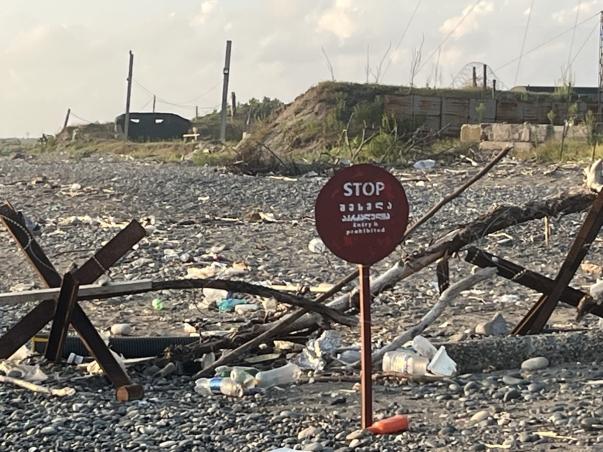
However, in the post-conflict period, the function of the river and the space created around it has sharply transformed. Today, the infrastructure existing along the Enguri: bridges, roads, checkpoints, and auxiliary objects—is no longer directed toward facilitating connection between territories. On the contrary, its main function is the control of space, restriction of movement, and ensuring administrative demarcation.
The Enguri Bridge, which previously represented the main channel of everyday mobility, today functions as a strictly regulated crossing where movement depends on political status, documents, and the security regime.
From a transport point of view, an integrated infrastructure that would connect the economic or social spaces of both sides does not exist on the Enguri line. Automobile and railway communications are broken or do not function in this direction, as a result of which Enguri no longer performs the role of a connecting corridor. Movement remains mainly a one-time, targeted, or necessity-based process and does not create stable social flows.
At the same time, the fragmentation of infrastructure and its asymmetrical accessibility strengthen spatial inequality. The Gali district, which is geographically close to the rest of Georgia, turned out to be infrastructurally more isolated than connected. Enguri in this case has turned not into a “zone for crossing” the border, but into a barrier that restricts everyday social practices.
Despite this, Enguri does not/cannot fully lose the potential of a connecting space. The informal practices, kinship ties, economic needs, and human contacts existing along the river indicate that social logic often goes beyond infrastructural and political frameworks. However, these connections today are no longer supported by formal infrastructure and function in a fragile, temporary, and high-risk regime.
At the same time, in the context of Enguri, the Enguri HPP acquires special significance, which maintains a functional space of cooperation even under conflict conditions. Its operation is based on continuous professional interaction between Georgian and Abkhaz energy specialists, which goes beyond only technical cooperation.
Despite the fact that existing agreements are often the subject of criticism, the Enguri HPP represents an example of successful practical cooperation in a politically divided environment.